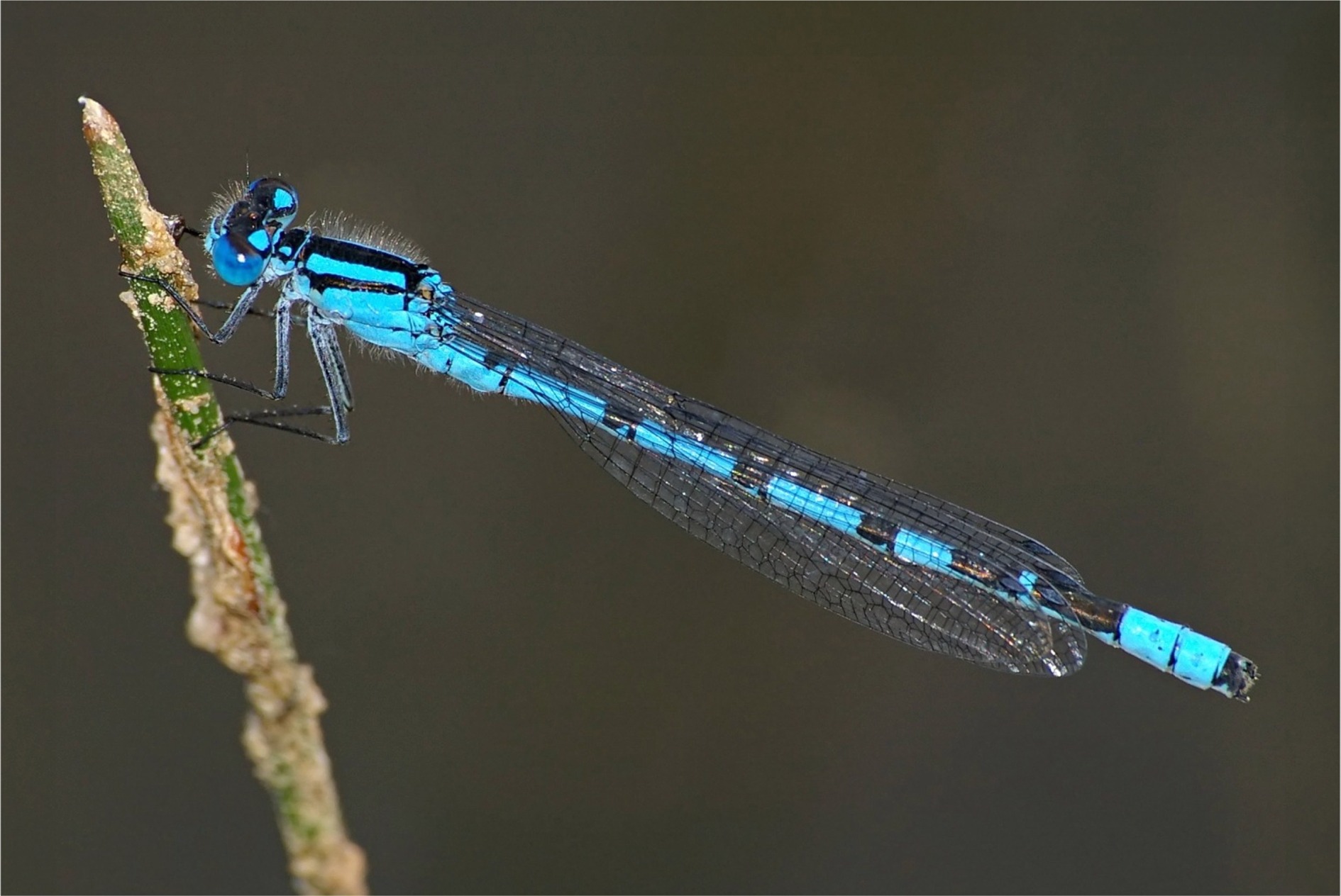
Verbreitung im Land-Salzburg MK-6.1447: Salzburg, Flachgau, Thalgau 4/12, 13.20° östl. L., 47.85° nördl. Br., 575.0 m Seehöhe LH0019-793: AT,Salzburg,Tennengau,Puch 1304998, 13.08° östl. L., 47.70° nördl. Br., 440.0 m Seehöhe zobodat-2029741: AUT, Salzburg, Wallersee-Moor, 13.17° östl. L., 47.92° nördl. Br., 510.0 m Seehöhe zobodat-2029743: AUT, Salzburg, Wallersee, 13.15° östl. L., 47.91° nördl. Br., 514.0 m Seehöhe zobodat-2029744: AUT, Salzburg, Prebersee, 13.85° östl. L., 47.18° nördl. Br., 511.5 m Seehöhe zobodat-2029745: AUT, Salzburg, Eglsee W Abtenau, 13.34° östl. L., 47.57° nördl. Br., 730.0 m Seehöhe zobodat-2029746: AUT, Salzburg, Salzburg-Leopoldskron, 13.04° östl. L., 47.78° nördl. Br., 430.0 m Seehöhe zobodat-2031002: AUT, Salzburg, Wenger Moor, 13.18° östl. L., 47.92° nördl. Br., 510.0 m Seehöhe zobodat-2031004: AUT, Salzburg, Eglsee W Abtenau, 13.34° östl. L., 47.57° nördl. Br., 730.0 m Seehöhe zobodat-2031005: AUT, Salzburg, Eglsee W Abtenau, 13.34° östl. L., 47.57° nördl. Br., 730.0 m Seehöhe MK-Z66367: Salzburg, St. Georgen, Waidmoos, 12.94° östl. L., 48.03° nördl. Br., 427.0 m Seehöhe MK-Z66368: Salzburg, Bürmoos, Zehmemoos, 12.93° östl. L., 48.00° nördl. Br., 438.0 m Seehöhe MK-Z66369: Salzburg, Bürmoos, Ortsgebiet, Teich, 12.93° östl. L., 47.99° nördl. Br., 439.0 m Seehöhe MK-Z66370: Salzburg, Nußdorf, Weitwörth, Badesee Auersperg, 12.96° östl. L., 47.92° nördl. Br., 397.0 m Seehöhe MK-Z66371: Salzburg, Anthering, Haunsberg, Pomed, 13.01° östl. L., 47.91° nördl. Br., 630.0 m Seehöhe MK-Z66372: Salzburg, Anthering, Antheringer Au, 12.99° östl. L., 47.88° nördl. Br., 405.0 m Seehöhe MK-Z66373: Salzburg, Anthering, Antheringer Au, 12.99° östl. L., 47.88° nördl. Br., 405.0 m Seehöhe MK-Z66374: Salzburg, Mattsee, NSG Obertrum am See, 13.08° östl. L., 47.94° nördl. Br., 507.5 m Seehöhe MK-Z66375: Salzburg, Köstendorf, NSG Wenger Moor mit Altbach, 13.18° östl. L., 47.93° nördl. Br., 509.0 m Seehöhe MK-Z66376: Salzburg, Köstendorf, NSG Wenger Moor mit Altbach, 13.18° östl. L., 47.93° nördl. Br., 509.0 m Seehöhe MK-Z66377: Salzburg, Köstendorf, NSG Wenger Moor mit Altbach, 13.18° östl. L., 47.93° nördl. Br., 509.0 m Seehöhe MK-Z66378: Salzburg, Köstendorf, NSG Wenger Moor mit Altbach, 13.18° östl. L., 47.93° nördl. Br., 509.0 m Seehöhe MK-Z66379: Salzburg, Köstendorf, NSG Wenger Moor mit Altbach, 13.18° östl. L., 47.93° nördl. Br., 509.0 m Seehöhe MK-Z66380: Salzburg, Köstendorf, NSG Wenger Moor mit Altbach, 13.18° östl. L., 47.93° nördl. Br., 509.0 m Seehöhe MK-Z66381: Salzburg, Köstendorf, NSG Wenger Moor mit Altbach, 13.18° östl. L., 47.93° nördl. Br., 509.0 m Seehöhe MK-Z66382: Salzburg, Köstendorf, NSG Wenger Moor mit Altbach, 13.18° östl. L., 47.93° nördl. Br., 509.0 m Seehöhe MK-Z66383: Salzburg, Köstendorf, NSG Wenger Moor mit Altbach, 13.18° östl. L., 47.93° nördl. Br., 509.0 m Seehöhe MK-Z66384: Salzburg, Hallwang, Ortsgebiet, 13.08° östl. L., 47.85° nördl. Br., 512.5 m Seehöhe MK-Z66385: Salzburg, Koppl, Winkl, Koppler Moor, Flugfeld NE, 13.15° östl. L., 47.81° nördl. Br., 765.0 m Seehöhe MK-Z66386: Salzburg, Koppl, Willischwandt, Teiche, 13.16° östl. L., 47.81° nördl. Br., 715.0 m Seehöhe MK-Z66387: Salzburg, Hof bei Salzburg, Fuschlsee, NW-Ufer, 13.25° östl. L., 47.81° nördl. Br., 665.0 m Seehöhe MK-Z66388: Salzburg, Hof bei Salzburg, Fuschlsee, NW-Ufer, 13.25° östl. L., 47.81° nördl. Br., 665.0 m Seehöhe MK-Z66389: Salzburg, Thalgau, Fischbachtal, Wasenmoos, NW Mooswirt, 13.25° östl. L., 47.87° nördl. Br., 767.0 m Seehöhe MK-Z66390: Salzburg, Thalgau, Kienberg, Müllnerbachtal (Stilles Tal), 13.29° östl. L., 47.81° nördl. Br., 710.0 m Seehöhe MK-Z66391: Salzburg, Hallein, Chemie-Fabrik, Salzachau (Puch), Auweiher, 13.08° östl. L., 47.71° nördl. Br., 440.0 m Seehöhe MK-Z66392: Salzburg, Hallein, Chemie-Fabrik, Salzachau (Puch), Auweiher, 13.08° östl. L., 47.71° nördl. Br., 440.0 m Seehöhe MKLit-Z91328: PF4, 12.79° östl. L., 47.54° nördl. Br., 1116.0 m Seehöhe GH00164-Z94577: AT, Sbg, Pinzgau, Saalfelden süd, Gruber, Schweiberg-Nebenmoor, 765m - Z3, 12.81° östl. L., 47.39° nördl. Br., 785.0 m Seehöhe MK-Z66393: Salzburg, Hallein, Chemie-Fabrik, Salzachau (Puch), Auweiher, 13.08° östl. L., 47.71° nördl. Br., 440.0 m Seehöhe MK-Z66394: Salzburg, Puch bei Hallein, St. Jakob am Thurn, Weiher, 13.09° östl. L., 47.74° nördl. Br., 512.0 m Seehöhe MK-Z66395: Salzburg, Vigaun, St. Margarethen, 13.13° östl. L., 47.68° nördl. Br., 461.0 m Seehöhe MK-Z66396: Salzburg, Abtenau, Zwieselalm, 13.47° östl. L., 47.55° nördl. Br., 1350.0 m Seehöhe MK-Z66397: Salzburg, Leogang, Grießensee, Grießener Moor, 12.64° östl. L., 47.46° nördl. Br., 957.0 m Seehöhe MK-Z66398: Salzburg, Mühlbach, Mitterberg, Hochkeil W, 13.13° östl. L., 47.40° nördl. Br., 1730.0 m Seehöhe MK-Z66399: Salzburg, Werfen, Blühnbachtal, Blienteckalm, 13.13° östl. L., 47.46° nördl. Br., 1420.0 m Seehöhe MK-Z66400: Salzburg, Werfenweng, Zaglauwinkel, Bischlingalm S, 13.30° östl. L., 47.45° nördl. Br., 1375.0 m Seehöhe MK-Z66401: Salzburg, Mittersill, Schellenberg, Schellenbergalm, Moorlacke, 12.43° östl. L., 47.32° nördl. Br., 1770.0 m Seehöhe MK-Z66402: Salzburg, Großarl, Ellmaubach-Tal, Saukarkopf, Trög, 13.26° östl. L., 47.25° nördl. Br., 1950.0 m Seehöhe MK-Z66403: Salzburg, Untertauern, Obertauern, Kehralm, 13.53° östl. L., 47.26° nördl. Br., 1745.0 m Seehöhe MK-Z66404: Salzburg, Untertauern, Obertauern, Gottschallalm, Scheckkopf, 13.51° östl. L., 47.26° nördl. Br., 1823.0 m Seehöhe MK-Z73772: Salzburg, Tennengau, Salzachtal, Puch, Tümpel, 13.08° östl. L., 47.70° nördl. Br., 444.0 m Seehöhe GH00164-Z78794: AT, Sbg, Pinzgau, Leogang, Grießen, Grißensee, 980m - Z2, 12.64° östl. L., 47.46° nördl. Br., 980.0 m Seehöhe GH00164-Z97439: AT, Sbg, Pinzgau, Saalfelden nord, Stoißen, Eingang Buchweißbachgraben, 740 m - Z2, 12.83° östl. L., 47.46° nördl. Br., 725.0 m Seehöhe


