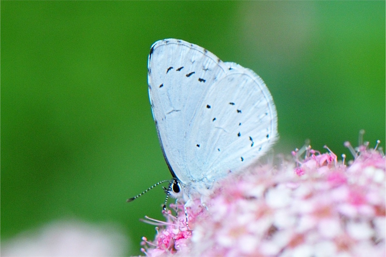
Verbreitung im Land-Salzburg MK-6.8966: Mündung Steiner-Bach, 13.17° östl. L., 47.92° nördl. Br., 506.0 m Seehöhe MK-404: Salzburg, Flachgau, Eugendorf, Unzing, Wörlemoos, 13.18° östl. L., 47.86° nördl. Br., 603.0 m Seehöhe MK-478: Salzburg, Flachgau, Eugendorf, Unzing, Wörlemoos, 13.18° östl. L., 47.86° nördl. Br., 603.0 m Seehöhe GE0017-11299: Salzburg, Maishofen: Mitterhofen, 12.81° östl. L., 47.37° nördl. Br., 500.0 m Seehöhe MK-7478: Oberösterreich, Mattsee, Lochen, Campingplatz Stein, 13.13° östl. L., 47.98° nördl. Br., 510.0 m Seehöhe MK-8377: Salzburg, Flachgau, Thalgau, 13.25° östl. L., 47.83° nördl. Br., 600.0 m Seehöhe MK-8378: Salzburg, Flachgau, Thalgau, Stilles Tal, 13.28° östl. L., 47.81° nördl. Br., 720.0 m Seehöhe ES0028-761: AT, Salzburg, Golling, Punkt 6, 13.19° östl. L., 47.58° nördl. Br., 550.0 m Seehöhe MK-10037: Salzburg, Stadt Salzburg, Leopoldskron, Sternhofweg, Fundstelle 2, 13.02° östl. L., 47.76° nördl. Br., 440.0 m Seehöhe MK-10059: Salzburg, Stadt Salzburg, Leopoldskron, Sternhofweg, Fundstelle 3, 13.03° östl. L., 47.76° nördl. Br., 439.0 m Seehöhe MK-10060: Salzburg, Stadt Salzburg, Leopoldskron, Sternhofweg, Fundstelle 3, 13.03° östl. L., 47.76° nördl. Br., 439.0 m Seehöhe MK-17328: Salzburg, Stadt Salzburg, Gnigl, Josef Waach-Straße 13/1, 13.06° östl. L., 47.81° nördl. Br., 430.0 m Seehöhe MK-17348: Salzburg, Stadt Salzburg, Gnigl, Josef Waach-Straße 13/1, 13.06° östl. L., 47.81° nördl. Br., 430.0 m Seehöhe PG0016-6072: A, Salzburg, Zell am See, Weißbach bei Lofer Ortsgebiet, 12.75° östl. L., 47.52° nördl. Br., 730.0 m Seehöhe PG0016-6073: A, Salzburg, Zell am See, Weißbach bei Lofer Ortsgebiet, 12.75° östl. L., 47.52° nördl. Br., 730.0 m Seehöhe MK-19369: Salzburg, Stadt Salzburg, Gnigl, Josef Waach-Straße 13/1, 13.06° östl. L., 47.81° nördl. Br., 430.0 m Seehöhe BIO0061-1402148: A, Salzburg, Salzburg-Umgebung, St. Georgen bei Salzburg: Holzhausen, Krögn, Waidmoos - PG-0981, 12.94° östl. L., 48.02° nördl. Br., 427.0 m Seehöhe MK-26001: Salzburg, Untersberggebiet, Großgmain, südlich Freilichtmuseum, 12.94° östl. L., 47.74° nördl. Br., 480.0 m Seehöhe MK-28696: Salzburg, Flachgau, Wallersee, Wenger Moor, Eisbach, F1, 13.17° östl. L., 47.92° nördl. Br., 510.0 m Seehöhe MK-28712: Salzburg, Flachgau, Wallersee, Wenger Moor, Eisbach, F3, 13.17° östl. L., 47.92° nördl. Br., 509.0 m Seehöhe MK-28741: Salzburg, Flachgau, Wallersee, Wenger Moor, Eisbach, F7, 13.17° östl. L., 47.92° nördl. Br., 512.0 m Seehöhe MK-28748: Salzburg, Flachgau, Wallersee, Wenger Moor Umgebung, F2, 13.17° östl. L., 47.92° nördl. Br., 514.0 m Seehöhe MK-Z46149: Salzburg, Stadt Salzburg, Gaisberg, Weg zum Aigner Park, 13.09° östl. L., 47.78° nördl. Br., 582.0 m Seehöhe BIO0061-1413305: A, Salzburg, Salzburg-Umgebung, Elixhausen: Ursprung, Ursprunger Moor - PG-0644, 13.06° östl. L., 47.88° nördl. Br., 560.0 m Seehöhe BIO0061-1411546: AUT, Salzburg, Salzburg (Stadt), Salzburg Stadt: Nonntal, Thumegger Bezirk, GE-0012, 13.04° östl. L., 47.78° nördl. Br., 425.0 m Seehöhe BIO0061-1412879: AT, Salzburg, Salzburg-Umgebung, Lamprechtshausen: Maxdorf, Weidmoos S, 12.94° östl. L., 48.02° nördl. Br., 427.0 m Seehöhe MK-Z52732: Salzburg, Stadt Salzburg, Mülln, Landeskrankenanstalten, Park, 13.03° östl. L., 47.80° nördl. Br., 440.0 m Seehöhe MK-Z53463: Salzburg, Stadt Salzburg, Gnigl, Josef Waach-Straße 13/1, 13.06° östl. L., 47.81° nördl. Br., 430.0 m Seehöhe BIO0061-1415051: A, Salzburg, Salzburg-Umgebung, Elixhausen: Ursprung, Ursprunger Moor - PG-0644, 13.06° östl. L., 47.88° nördl. Br., 560.0 m Seehöhe BIO0061-1415227: A, Salzburg, Salzburg-Umgebung, Elixhausen: Ursprung, Ursprunger Moor - PG-0644, 13.06° östl. L., 47.88° nördl. Br., 560.0 m Seehöhe MK-Z55203: Salzburg, Stadt Salzburg, Gnigl, Weg auf den Heuberg, F12, 13.08° östl. L., 47.82° nördl. Br., 535.0 m Seehöhe GH00164-Z62459: Salzburg, Fusch, Ferleiten, Glocknerstr., Forschungsstation, 2260m, 12.81° östl. L., 47.12° nördl. Br., 2260.0 m Seehöhe GH00164-Z101315: AT, Sbg, Pinzgau, Saalfelden süd, Gruber, oberh. Buschhalde, 750m - Z3, 12.82° östl. L., 47.40° nördl. Br., 750.0 m Seehöhe GH00164-Z63955: Salzburg, Saalfelden, Kollingwald, Mitte, 12.84° östl. L., 47.41° nördl. Br., 800.0 m Seehöhe MK-Z64511: Salzburg, Stadt Salzburg, Gnigl, Josef Waach-Straße 13/1, 13.06° östl. L., 47.81° nördl. Br., 430.0 m Seehöhe BIO0061-1415657: A, Salzburg, Salzburg-Umgebung, Anif: Waldbad Anif - PG-1764, 13.08° östl. L., 47.73° nördl. Br., 437.0 m Seehöhe GH00164-Z65926: Salzburg, Saalfelden, nord, Steinalm, Hüttenbereich, 1250m, 12.87° östl. L., 47.44° nördl. Br., 1250.0 m Seehöhe GH00164-Z65928: Salzburg, Saalfelden nord, Steinalm Boden, 1200m, 12.86° östl. L., 47.44° nördl. Br., 1200.0 m Seehöhe GH00164-Z68389: Salzburg, Saalfelden, west, Alte Saalach-Huntwald, 740m, 12.81° östl. L., 47.42° nördl. Br., 730.0 m Seehöhe MK-Z70378: Salzburg, Stadt Salzburg, Sam, Sam Moos, F1, 13.07° östl. L., 47.82° nördl. Br., 432.0 m Seehöhe MK-Z70527: Salzburg, Flachgau, Wallersee Moor, Zeller Moor, 13.17° östl. L., 47.92° nördl. Br., 513.0 m Seehöhe MK-Z70826: Salzburg, Pinzgau, zwischen Mittersill und Hollersbach, F2, 12.46° östl. L., 47.27° nördl. Br., 798.0 m Seehöhe MK-Z71220: Salzburg, Flachgau, St. Georgen, Weidmoos, Aussichtsplattform, 12.94° östl. L., 48.02° nördl. Br., 426.0 m Seehöhe GH00164-Z74849: AT, Sbg, Pinzgau, Saalfelden süd, Gruber, um Hof, 740m - Z3, 12.82° östl. L., 47.40° nördl. Br., 740.0 m Seehöhe GH00164-Z77937: AT, Sbg, Pinzgau, Saalfelden süd, Gruber, oberh. Buschhalde, 750m - Z3, 12.82° östl. L., 47.40° nördl. Br., 750.0 m Seehöhe MK-Z87686: Salzburg, Stadt Salzburg, Gnigl, Josef Waach-Straße 13/1, 13.06° östl. L., 47.81° nördl. Br., 430.0 m Seehöhe MK-Z87774: Salzburg, Stadt Salzburg, Mülln, Landeskrankenanstalten, Park, 13.03° östl. L., 47.80° nördl. Br., 440.0 m Seehöhe MK-Z88824: Salzburg, Stadt Salzburg, Heuberg, Nähe Schöne Aussicht, F2, 13.08° östl. L., 47.81° nördl. Br., 565.0 m Seehöhe MK-Z91915: Salzburg, Stadt Salzburg, Gnigl, Josef Waach-Straße 13/1, 13.06° östl. L., 47.81° nördl. Br., 430.0 m Seehöhe MK-Z94482: Salzburg, Stadt Salzburg, Heuberg, Drei-Eichenweg, F8, 13.07° östl. L., 47.82° nördl. Br., 506.0 m Seehöhe MK-Z95270: Salzburg, Stadt Salzburg, Gnigl, Josef Waach-Straße 13/1, 13.06° östl. L., 47.81° nördl. Br., 430.0 m Seehöhe GH00164-Z96992: AT, Sbg, Pinzgau, Saalfelden nord, Bürgerau, um Schlossbrücke, 880m - Z2, 12.86° östl. L., 47.44° nördl. Br., 880.0 m Seehöhe MK-Z101225: Salzburg, Stadt Salzburg, Sam, Sam Moos, 13.07° östl. L., 47.82° nördl. Br., 434.0 m Seehöhe MK-Z101579: Salzburg, Stadt Salzburg, Gnigl, Josef Waach-Straße 13/1, 13.06° östl. L., 47.81° nördl. Br., 430.0 m Seehöhe MK-Z101636: Salzburg, Stadt Salzburg, Gnigl, Josef Waach-Straße 13/1, 13.06° östl. L., 47.81° nördl. Br., 430.0 m Seehöhe MK-Z101639: Salzburg, Stadt Salzburg, Gnigl, Josef Waach-Straße 13/1, 13.06° östl. L., 47.81° nördl. Br., 430.0 m Seehöhe


