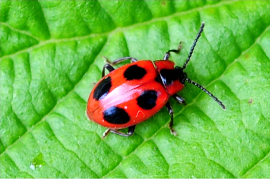
Verbreitung im Land-Salzburg zobodat-1772457: AUT, Salzburg, Salzburg, 13.04° östl. L., 47.80° nördl. Br., 1025.0 m Seehöhe zobodat-1772458: AUT, Salzburg, Hirzbachtal b. Fusch, 12.77° östl. L., 47.21° nördl. Br. zobodat-1772461: AUT, Salzburg, Untertauern, 13.50° östl. L., 47.30° nördl. Br., 436.0 m Seehöhe zobodat-1772462: AUT, Salzburg, Fusch a.d. Glocknerstrasse, 12.82° östl. L., 47.22° nördl. Br., 810.0 m Seehöhe zobodat-1772516: AUT, Salzburg, Klessheim b. Salzburg, 12.99° östl. L., 47.82° nördl. Br., 429.0 m Seehöhe zobodat-1772517: AUT, Salzburg, Anlauftal S Gastein, 13.13° östl. L., 47.07° nördl. Br., 1193.0 m Seehöhe zobodat-1772518: AUT, Salzburg, Untersberg, 12.98° östl. L., 47.71° nördl. Br., 436.0 m Seehöhe zobodat-1772519: AUT, Salzburg, Schlenken (Osterhorngr.), 13.21° östl. L., 47.68° nördl. Br., 1649.0 m Seehöhe zobodat-1772520: AUT, Salzburg, Kapuzinerberg, 13.05° östl. L., 47.80° nördl. Br., 600.0 m Seehöhe zobodat-1772521: AUT, Salzburg, Klessheim b. Salzburg, 12.99° östl. L., 47.82° nördl. Br., 429.0 m Seehöhe zobodat-1772522: AUT, Salzburg, Gollinger Wasserfall, 13.13° östl. L., 47.06° nördl. Br., 502.0 m Seehöhe zobodat-1772523: AUT, Salzburg, Muntigl, 13.01° östl. L., 47.85° nördl. Br., 422.0 m Seehöhe zobodat-1772524: AUT, Salzburg, Kapuzinerberg, 13.05° östl. L., 47.80° nördl. Br., 600.0 m Seehöhe zobodat-1772525: AUT, Salzburg, Haunsberg, 12.99° östl. L., 47.91° nördl. Br., 800.0 m Seehöhe zobodat-1772526: AUT, Salzburg, Gaisberg b. Salzburg, 13.11° östl. L., 47.80° nördl. Br. zobodat-1772527: AUT, Salzburg, Gaisberg b. Salzburg, 13.11° östl. L., 47.80° nördl. Br. zobodat-1772528: AUT, Salzburg, Klessheim b. Salzburg, 12.99° östl. L., 47.82° nördl. Br., 429.0 m Seehöhe MG0074-Z30014: AT, Salzburg, Elsbethen, Eglsee, 13.13° östl. L., 47.75° nördl. Br., 700.0 m Seehöhe MG0074-Z30016: AT, Oberösterreich, Weißenbach, Weißenbachtal Mitte, 13.60° östl. L., 47.77° nördl. Br., 550.0 m Seehöhe MG0074-Z30017: AT, Salzburg, Salzburg Stadt, Salzachseeen, 13.01° östl. L., 47.83° nördl. Br., 420.0 m Seehöhe MG0074-Z30018: AT, Salzburg, Salzburg Stadt, Kapuzinerberg-West, 13.05° östl. L., 47.80° nördl. Br., 500.0 m Seehöhe MG0074-Z30019: AT, Salzburg, Salzburg Stadt, Kapuzinerberg-Gipfel u.Nord, 13.05° östl. L., 47.80° nördl. Br., 600.0 m Seehöhe MG0074-Z30020: D, Bayern, Maria Ettenberg, 13.02° östl. L., 47.67° nördl. Br., 800.0 m Seehöhe MG0074-Z30023: AT, Salzburg, Salzburg Stadt, Gaisbergrundwanderweg, 13.10° östl. L., 47.79° nördl. Br., 1000.0 m Seehöhe MG0074-Z30046: AT, Salzburg, Salzburg Stadt, Mönchsberg, 13.03° östl. L., 47.80° nördl. Br., 490.0 m Seehöhe MG0074-Z30047: AT, Salzburg, Salzburg Stadt, Hellbrunn Schlosspark, 13.06° östl. L., 47.75° nördl. Br., 430.0 m Seehöhe MG0074-Z31859: AT, Salzburg, Nußdorf, Weitwörth, Salzachau, 12.95° östl. L., 47.90° nördl. Br., 400.0 m Seehöhe MG0074-Z31942: AT, Salzburg, Salzburg Stadt, Kapuzinerberg-Süd, 13.05° östl. L., 47.80° nördl. Br., 500.0 m Seehöhe MG0074-Z59417: AT, Salzburg, Nußdorf, Weitwörth, Salzachau, 12.95° östl. L., 47.90° nördl. Br., 400.0 m Seehöhe MG0074-Z97028: D, Bayern, Markt Schellenberg, Weißbachgraben, 800 m, 13.01° östl. L., 47.70° nördl. Br., 800.0 m Seehöhe


